


Understanding the region where my Polish ancestors came from in the Ukraine.
Understanding the region where my Polish ancestors came from in the Ukraine.
Link to Leon Sawicki (Vicenty’s grandson) Born in Ternopil, in the west.
Link to Joseph Sawicki (Vicenty’s son)
Link to a short history on Galacia
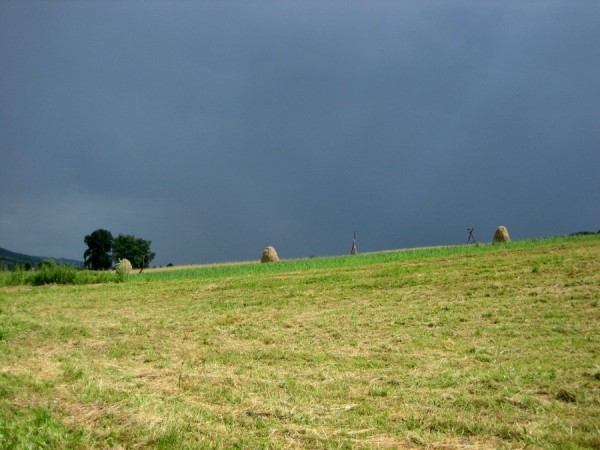
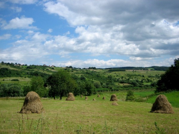
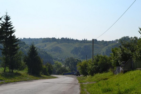
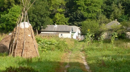
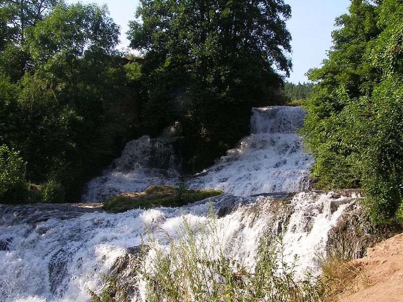
Video of the land where Skala is
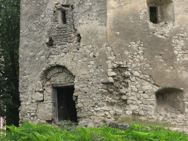
Another video of the Skala castle
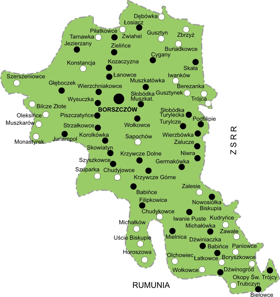
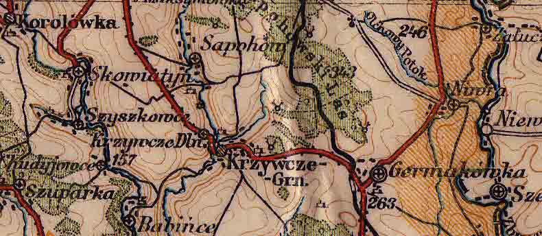
Take note of Skala in the upper right of the map. That is the village where my grandfather, Leon Sawicki was born. I must say, the family emigrated to Canada at the right time because there was a whole lot of political turmoil and war coming to the region.
Ternopil Oblast: Geography
The oblast is located in the West Ukraine and has an area of 13,800 km². It is situated at the western part of the Podilian Upland which is known for its quite rocky terrain. Among noticeable mountains there is the Kremenets Mountains. The oblast is also famous for its caves.
One of the major rivers in the country Dniester forms southern and southwestern borders of Ternopil Oblast with the adjacent Chernivtsi Oblast and Ivano-Frankivsk Oblast. Its tributaries that flow through the oblast include Zbruch, Seret, and Strypa among just few of them. The Seret River (not to be confused with Siret nor Seret) is a left tributary of the Dniester flowing through the oblast administrative center, i.e. Ternopil.
Ternopil Oblast is one of the two in the West Ukraine that do not have an international border. It is surrounded by five other oblasts of Ukraine: Chernivtsi Oblast – to the south, Ivano-Frankivsk Oblast – to the southwest, Lviv Oblast – to the northwest, Rivne Oblast – to the north, and Khmelnytskyi Oblast – to the east.
BORSHCHIV – BORSZCZOW – BORSHCHEV
TOWN AND VICINTIES
http://www.personal.ceu.hu/students/97/Roman_Zakharii/borshchiv.htm
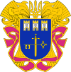
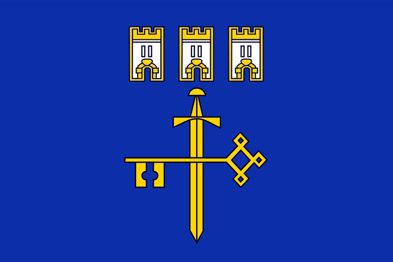
Pre war coat of arms of Borshchiv used before 1939
H O M E L A N D – P A G E
| BORSHCHIV is Ukrainian name. Polish name (as well as Austrian place name): Borszczow. Russian name: Borshchev. Hungarian name: Borscsov. Other tranliterations that occur: Borshchov, Borstchoff, Borshtshiv, Borszcziw, Borschtschiw.
It is small town in WESTERN UKRAINE, which numbers about 12.000 people. Located in southern part of Ternopil region, in south eastern part historic area Halychyna (Galizien, Galicia, Galizia, Galicja) which was part of Austria (1772 – 1918), Poland (1920 – 1939), Soviet Union (1939 – 1991). Nowadays it is district center in Ternopilska oblast of Western Ukraine. |
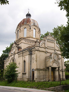
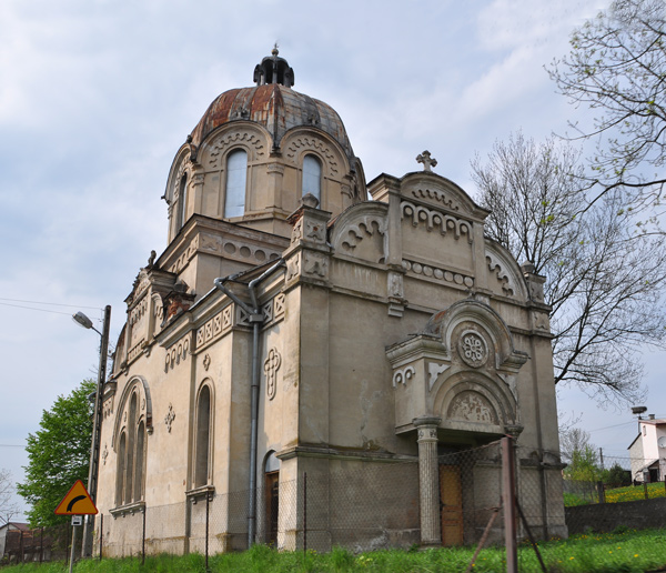
Above at the picture: ROMAN CATHOLIC CHURCH IN BORSHCHIV
Borshchiv Roman Catholic Church dates from the end of 18 th century. The church itself is built of bricks, cross-like in plan with tower of three layers on the front facade. The stretched rectangular nave is closed with faceted apse. Flooring is flat. The church tower was built of defensive tower of an ancient castle of 17th century. Thus the walls of tower´s lower layer are thicker than upper ones. Facated upper tower layers have baroc completion.
Borshchiv’s coat of arms (picture at the top) during Polish rule (1920 – 1939) represented a slit with argent and gules stripes shield and an or sheaf in it. Name Borshchiv derives from Ukrainian / Slavic word “Borshch” which is Ukrainian traditional dish (soup of red root-beets). You can get to Borshchiv by train or road from Ternopil. It will take about 2- 3 hours. Borshchiv’s telephone code is 3541 if you phone withing Ukraine and + 380 3541 if you phone from abroad.
Borshchiv: From Wikipedia, the free encyclopedia
Borshchiv (Ukrainian: Борщів, Russian: Борщёв, Polish: Borszczów) is a city in the Ternopil Oblast (province) of western Ukraine. It is the administrative center of the Borshchiv Raion (district) and is located at around 48°48′10″N 26°2′11″ECoordinates: 48°48′10″N 26°2′11″E. City population is 11,382 (2001).
Borshchiv has been mentioned under its name as the Dudinski family manor since 1456. In 1629 the town, which at that time belonged to the Kingdom of Poland was granted a Magdeburg charter, and the coat of arms, which was the symbol of the House of Vasa. In 1672–1683 the town was controlled by Ottoman Turks (see Polish–Ottoman War (1672–76)). After the First Partition of Poland (1772), the town was annexed by the Habsburg Empire. In 1809–1815 it was controlled by the Russian Empire and then returned to Austrians. In 1914–1917 it was taken over by the Russian troops again, see Russian occupation of Eastern Galicia, 1914–15. From 1919 to September 1939 it belonged to Poland, and due to proximity of the Polish-Soviet border, a Border Protection Corps Battalion Borszczow was stationed here. In the Second Polish Republic, Borszczow was the seat of a county (powiat) in Tarnopol Voivodeship.
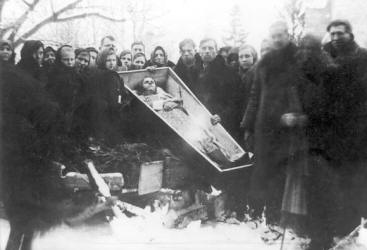
Following the Soviet invasion of Poland in September 1939, the town was annexed by the Soviet Union. It was also occupied by the Hungarian army from July to August 1941. During World War II, several mass executions of Jews were carried out in the town. In April 1942 a Borshchiv Jewish ghetto was established here. Between spring and summer of 1943, approximately 400 Jews were sent to the Ivanovka camp and more than 2,300 Jews were shot in the Jewish cemetery.[1] After a short period of rule by the Germans at the beginning of World War II it was ceded back to the Russians until the fall of the USSR and declaration of Ukrainian independence.
The Borshov Horizon or Borshovian Horizon is a geological layer of marl and limestone formed in the lowermost Devonian period.[2] Typical specimens of this province have been recorded in the Upper Dniester valleys near Borshchiv where it reaches the surface layers of the land. It is marked by the presence of microscopic Margachitina chitinozoans,[2] certain trilobites and bryozoa dispersed in grainstone. According to Pushkin, waterborne Bryozoa living in shallow lagoons were the dominant life form that shaped the Borschovian plains. Some areas of the Borschovian layer were dominated by colonies of a single species where others were populated by a mix of different Bryozoa.[3]
https://en.wikipedia.org/wiki/Ternopil_Oblast
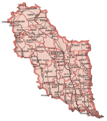
Villages of the Borshchiv region. The main city is Borshchiv.
There are 70 villages (selo) within the raion, 2 urban-type settlements and one city (misto) – Borshchiv. The major villages in Borshchiv district include:
Names are given in Ukrainian followed by Polish and Russian names in brackets. Some of the villages listed below (those located to the southeast of Borshchiv), belong administratively to the bordering Zalishchytskyi Raion.
Babyntsi (Babińce / Babintsy) — 18 km south of Borshchiv. The name derives from the Ukrainian word “baba” (grandmother, woman). It was an old Rus fortified settlement with ramparts around it, which are preserved.
Bedrykivtsi (Bedrykowce / Bedrikovtsy) — Is 34 km southwest of Borshchiv, in the Zalishchyky district, only 10 km north from Zalishchyky, on a minor river which is a tributary of the Seret / Dniester. The name derives from the Ukrainian word “bedro” (rib). The village is very old; it had a prehistoric settlement. It also has an old graveyard.
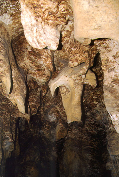
Bilche Zolote (Bilcze Złote / Bilche Zolotoye) — A village with a park of 1800 hectares (4448 acres) of which 11 hectares (27 acres) are planted with 400-year-old trees. Bilche Zolote is located some 16 km (9.9 mi) west of Borshchiv. The village is known for a significant Neolithic Cucuteni-Trypillian culture archaeological site dating back to the 4th millennium B.C., a small palace, and the large gypsum karst Verteba Cave, which was used in World War II as a hiding place for Ukrainian Jews who fled the Nazis during The Holocaust in Ukraine, a story that was featured in the June/July 2004 issue of the National Geographic Adventure Magazine, as well as numerous other journal articles.[1]
Burdyakivtsi (Burdiakowce / Burdyakovtsy) — Is 15 km northeast of Borshchiv. It is not far from the Zbruch river.
Dzvenyhorod (Dźwinogród / Dzvenigorod) — Has an Assumption Church (Uspenska tserkva) with belfry. It is located on the slope of a mountain next to the Dniester (Dnister) river. The church dates from 1801 but the western part was reconstructed in 1861. The village is located in the southern part of the Borshchiv district, on the bank of the Dniester river (during 1920–1939 when Dzvenyhorod was part of Poland, the river Dniester was the border between Poland and Romania’s Bukovina).
I
vana-Puste (Iwanie Puste / Ivana Pustoye) has the wooden church of St John with a belfry. The church dates from 1775 (Polish kingdom times, two years before Ivana Puste came under Austrian rule) and is a monument to the old Podolian school of people’s architecture.
Hermakivka (Germakówka / Germakovka) is a small village, located 20 km southeast of Borshchiv, 5 km west of the river Zbruch. The Zbruch was the border between the Austrian and Russian empires during 1772–1918. (Hermakivka was on the Austrian side of the river). What is remarkable about Hermakivka is that there is a Trayan wall (Wal Trajana in Polish and Trajaniv Val in Ukrainian), south of the village. It stretches from Hermakivka south via Zalissya and Kdryntis to the river Dniester. The Trayan wall was built by the Romans (under the emperor Trajan), as the northeastern border of the Roman Empire (province of Dacia).
Holihrady, Goligrady (Holihrady / Gologrady) is located on the left bank of the Seret river, 23 km southwest of Borshchiv. The village has an old stone church and a fabulous cave.
Horodok (Gródek / Gorodok) is a village on the isthmus of the Seret and Dniester rivers, 33 km southeast of Borshchiv, not far from the town of Zalishchyky. Note that there is major town with the same name in the Lviv region of Western Ukraine. The name literally means “little town”. It had an old pre-historical settlement and a burial ground was also discovered here.
Kapustyntsi (Kapuścińce / Kapustintsy) — Is a village 22 km northwest of Borshchiv, on the left bank of the river Seret. The name comes from the Slavic root “Kapusta” (cabbage). There used to be a Rus settlement here and there was also a medieval town.
Kasparivtsi (Kasparowce / Kasparovtsy) — is 30 km southwest of Borshchiv, on the river Seret. Many old coins have been found in this village. It has an eighteenth-century stone church.
Korolivka (Korolówka / Korolevka) — Is 10 km south of Borshchiv. Korolivka boasts a palace and cave.
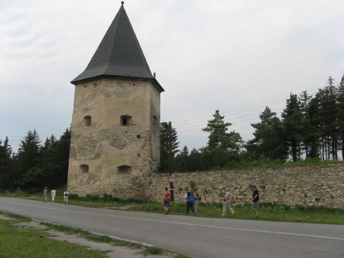
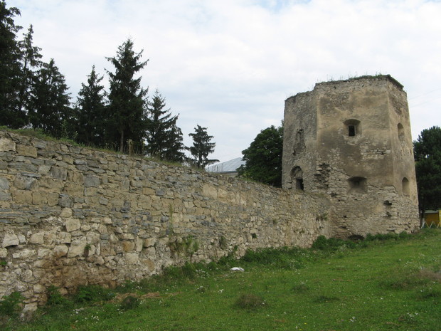
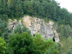
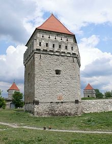
Kryvche (Krzywcze / Krivche). Kryvche is known mainly because of its cave system, one of the longest in the world. It is also known for Kryvche castle which dates from first half of the 17th century and is built of sandstone, representing a typical castle from that period.
Kudryntsi (Kudryńce / Kudrintsy) also boasts a 17th-century castle. This one is located on the plateau of a steep mountain over the river Zbruch. This river was the border between the Austrian and Russian empires. Kudryntsi was on the right bank of Zbruch, i.e. the Austrian side). The original wojts of this region were of the noble house Kudrycki z Kudrynce h. Labedz i.e. Herb Labedz; from the period predating the Polish Lithuanian Commonwealth, probably of the Grand Duchy of Lithuania. The castle was fortified about 1386 following the Kreva agreement. Legend has it the castle is linked with Kryvche via underground sandstone caves. This castle fortress is also built of sandstone, but it is non-regular in plan and has three corner towers. It was reconstructed in the 18th century. The Trayan Wall passes through Kudryntsi (from Hermakivka via Zalissya and Kudryntsi south to the river Dniester). This wall was built by the Roman emperor Trajan, and served as the north-eastern border of the Roman Empire.
Kulakivtsi (Kułakowce / Kulakovtsy) — Is 32 km southwest of Borshchiv, on the isthmus of the rivers Dniester and Seret. The name comes from the Slavic word “kulak” (fist). The village has a 19th-century wooden church.
Lanivtsi (Łanowce / Lanovtsy) — Is a village 5 km northwest of Borshchiv. It has the remains of an old fortified settlement.
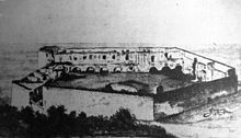
Okopy
https://en.wikipedia.org/wiki/Borshchiv_Raion
Chortkiv: From Wikipedia, the free encyclopedia
Chortkiv (Ukrainian: Чортків; Polish: Czortków; Yiddish: טשאָרטקאָוו Chortkov) is a city in Ternopil Oblast (province) in western Ukraine. It is the administrative center of the Chortkiv Raion (district), housing the district’s local administration buildings. Chortkiv is located in the northern part of the historic region of Galician Podolia on the banks of the Seret River.[3] Its population was 28,855 as of the 2001 Ukrainian Census.[1] Due to heavy destruction of Ternopil, in 1944 Chortkiv served as a regional seat.[4]
In the past Chortkiv was the home of many Hasidic Jews; it was a notable shtetl and had a significant number of Jews residing there prior to the Holocaust. Today, Chortkiv is a regional commercial and small-scale manufacturing center.[3] Among its architectural monuments is a fortress built in the 16th and 17th centuries[5] as well as historic wooden churches of the 17th and 18th centuries.[6]
History
The first historical mention of Chortkiv dates to 1522, when Polish King Sigismund I the Old granted an ownership order for Jerzy Czortkowski over the town and allowed him to name it after himself—Czortków.[6] During that time, the town was also granted Magdeburg rights.[3] However, Chortkiv would later decline in the second half of the 17th century during Ottoman Expansion of central Europe the town was taken over by Ottoman Empire,[3] whose rule lasted 27 years. It was part of the short-lived Turkish Podolia Eyalet, which lasted from 1672 to 1699.
After First Partition of Poland Chortkiv came under Austro-Hungarian rule which lasted from 1772 to 1918, during the time of which it was the center of the Chortkiv Bezirk. On June 8, 1919 the Ukrainian Galician Army broke for couple months through the Polish front at Chortkiv and began the Chortkiv offensive.[3] Soon afterwards, the town was seized by the Poles. It was ceded to sovereign Poland in the Peace Treaty of Riga between Poland, Soviet Russia (acting also on behalf of Soviet Belarus) and Soviet Ukraine, and remained part of the Tarnopol Voivodeship of the Second Polish Republic until the Soviet invasion of Poland in September 1939.
In 1931, the town had 19,000 inhabitants, 22.8 percent of whom were Ukrainians (Greek Catholics), 46.4 percent of whom were Poles (Roman Catholics), and 30 percent of whom were Jews. Chortkiv was an important garrison of the Polish Border Defence Corps Brigade “Podole”, whose commandant from 1935 to 1938 was General Stefan Rowecki. Furthermore, it was home to the 36th Reserve Infantry Division.
The town was annexed to the Soviet Union from September 17, 1939 until June 1941. Its Polish inhabitants, particularly students of the local high school, organized a failed uprising in January 1940,[7] which would serve as the first Polish uprising of World War II. From 1941-1944 it was annexed to Nazi Germany. After the defeat of the Nazis by the Red Army in 1944, the town returned to Soviet control until in 1991 it became part of independent Ukraine. Polish residents of the town were transferred to the Recovered Territories in the immediate postwar period (see Polish population transfers (1944–1946)).
https://en.wikipedia.org/wiki/Chortkiv
SKALA PODILSKA (Polish and Russian names: SKALA PODOLSKA / SKALA PODOLSKAYA)
Name literally means “Podolian rock”. Skala Podolska is remarkable to visit because of its ancient castle ruins. It is on river Zbruch, 20 km north east of Borshchiv. Skala Castle date to 1538 and was reconstructed out of medieval castle (14 – 15th centuries), which in its turn emerged on the place of ancient Rus settlement. Castle is located on the high rock in northern part of the city. The rock steeply ascends down to the river Zbruch on its eastern side and on the west and north to the brook down the rock. Skala Podilska has also a palace and 18 th century Roman Catholic stone church (it has Polish community).
Czortkow Ukraine videp (7 min, 2006). This could be a church of the Sawicki ancestors
https://www.youtube.com/watch?v=Y2x3fp-3X2M
Czortkow pre-1939 23 min 2015
https://www.youtube.com/watch?v=Rqfr-Ey-3eM
Czortkow streets (9 min 2006) Huge catholic church.
https://www.youtube.com/watch?v=R0X8UMedCtM
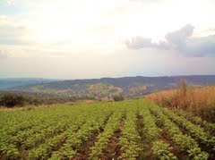
Krzywcze caves (8 min, 2006) There is some landscape. It is sure easy to see why the immigrants chose Manitoba. The land is very similar.
https://www.youtube.com/watch?v=3w6Qftlnzvc
Kryvche Ukraine, Celo (4 min 2006) Farmland, creek, ducks, small farming villages, castle,
https://www.youtube.com/watch?v=n0C-odkW7Lw
Kryvche Ukraine tourist video, (7 min, 2014)
Monastyrok (Ternopil oblast) scene of the seret river (1:30 min) 2006
https://www.youtube.com/watch?v=uVkUUbEv6Bw
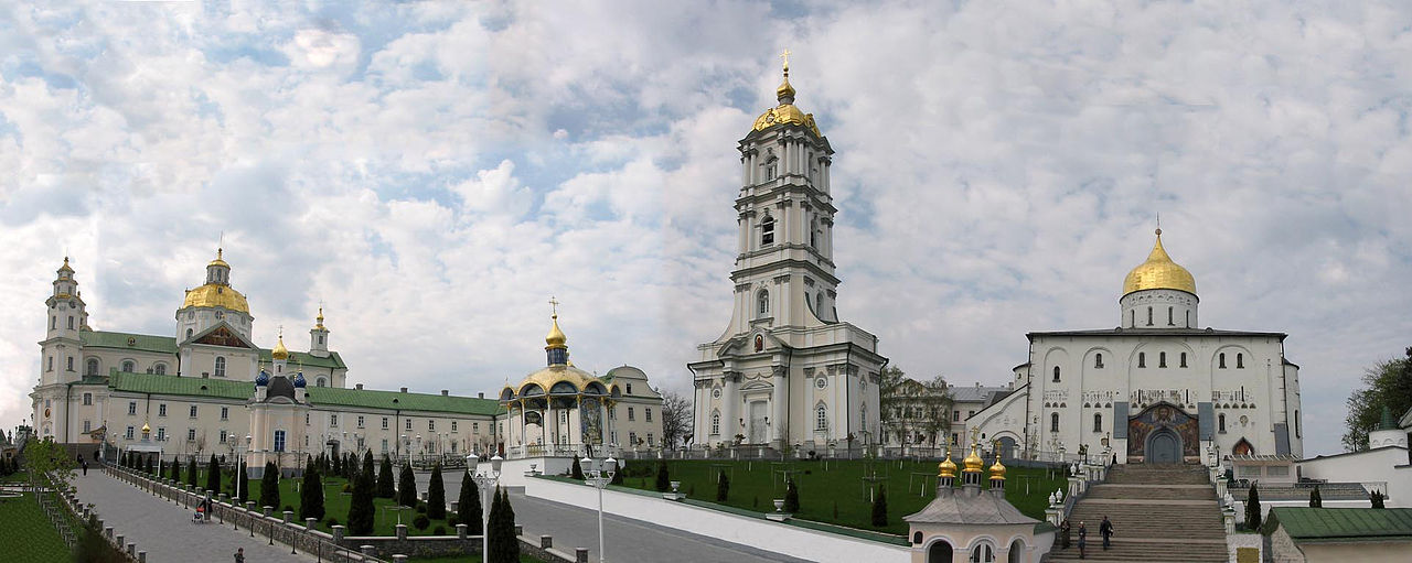
Ternopil castle video ( 3 min) tv interview of ctizens there. Older ladies with babushka’s and needle point.
https://www.youtube.com/watch?v=bkWSxJBZXCo
The country of Ternopil (45 min. 2011)
https://www.youtube.com/watch?v=jwC8vGuK1d8


Interact with us using Facebook